
The deadline for objections ended 19th May 2025Thank you to all that that studied the information provided and made their objections known via our form. For anyone who signed up to our newsletter, we will keep you informed.
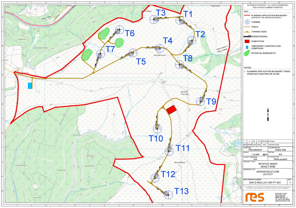
Wind farm of 13 turbines with a maximum tip height of 149.9m from ground level. Overlooking Cwmbran, Penyrheol and Pantygasseg.
Well, this is the proposal in as much detail as RES have made public!
There is no doubt about it, the wind farm proposed by RES on Mynydd Maen is massive and it will adversely affect the lives of people who live nearby.
Each turbine will be 150m high, and there will be 13 of them crammed up on top of our beautiful mountain.
One will dominate The Square, all will be visible from Pantygasseg, yet the drawing above has avoided including either place.
Two of them will dominate Cwm Lickey.
Click on image to enlarge.
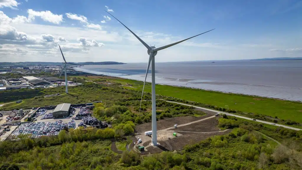
There is only one single turbine of this size in England, on an industrial estate in Avonmouth on waste land between a power station and a massive scrap yard. Turbines you have seen on your travels are probably only half this height, and less numerous.
Click on image to enlarge.
Note, Although this is called Mynydd Maen wind farm and it is on what is locally known as Mynydd Maen it is more accurately described as Mynydd Twyn Glas, the trig point being 472m high. This is higher than Twmbarlwm at 419m.
The Twmbarlwm / Mynydd Maen ridge is the first high ground you see in Wales after crossing the Severn Bridge and it is a beautiful walk.
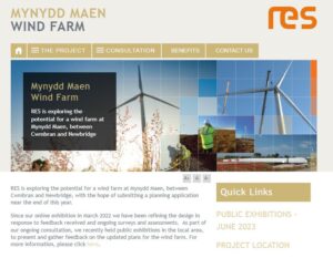 Their website on their proposals can be found here, Look at the June 2023 exhibition for brief details of the latest information.
Please read carefully!
Summary
13 turbines each 150m high (more accurately 149.9m high) each 4.2MW producing up to 54.6MW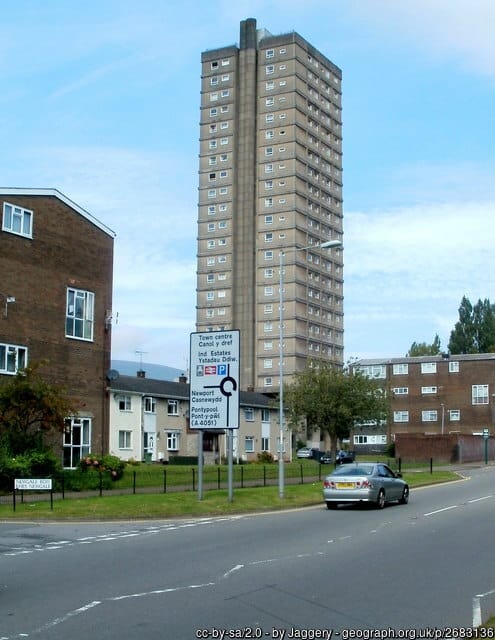
Each turbine is twice as high as Cwmbran’s very own 22 storey block of flats and bigger than any turbine in England except for a single one community owned turbine on an industrial estate in Avonmouth. The specification given by RES is such that they may well be proposing the very same turbines.
Each of the 13 turbines will be as high as the single one highest turbine in England.
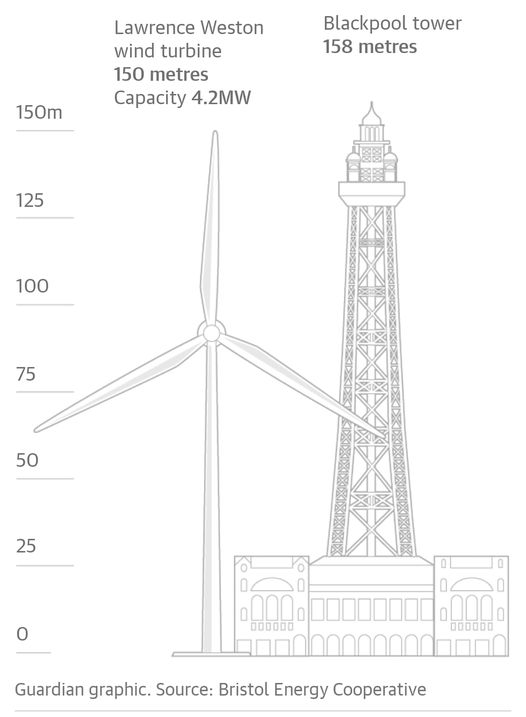 Other comparisons include that the turbines heights are very close to the height of Blackpool tower.
The nearest community to the development is Pantygasseg elevation 329m, 1.038km from the nearest turbine. A photomontage from here was presented at the exhibition in Cwmbran.
The next nearest community in Cwmbran is The Square, Upper Cwmbran elevation 223m, 19 residents, 10 houses. 1.36km from Turbine T9. RES had no photomontage from The Square and HAD NO INTENTION OF PREPARING ONE. They admitted this after lots of questioning at the exhibition and over a number of weeks after the exhibition.
Only after a lot of nagging, cajoling and persuasion have RES eventually agreed to prepare and add a photomontage from the Square to their submission to PEDW.
After the original online consultation in March 2022 The Project Manager for RES admitted that they were totally unaware of the existence of The Square, Upper Cwmbran, let alone it’s proximity to the proposed wind farm. In the June 2023 exhibitions they had obviously chosen to ignore it’s existence, having trimmed their maps to exclude and having faded out surrounding dwellings.
There are also two farms just over 1km from their nearest turbines, and two cottages in Upper Cwmbran just 1km from Turbine T9
Blaen Bran Community Woodland is less than 500m from the nearest turbine and the management of this woodland have not been consulted. When queried this I was told “They won’t be seen through the trees”. Wrong!
UPDATE (following publication of draft DNS documents) RES as promised have produced a photomontage from The Square. It shows Turbine T9 standing menacingly above the conservation area. They have provided this to selected residents but have stated that categorically it WILL NOT be included in the planning application! See this photomontage here.
The project will require the removal of various depths of peat over a many acres of the mountain top for the bases of the turbines and the working area around each (realistically about 1.8 acres for each turbine taking in total 23.4 acres). Where will this peat go except on top of the peat alongside? (smothering and disturbing another 23 acres?)
The project will require the building of about 8 km of roads which appear on the DNS application to be 5.5m wide, although road drawing strangely has no dimensions on it. “TRACK WIDTH TO INCREASE ON BENDS AND PASSING PLACES”, passing place might be very long to accommodate long loads. It looks that from their un-dimensioned drawing (here) the total width of peat disturbed by the road, cable tranches, drainage trenches and the sub-base will be up to 22m! These will require the removal of a vast areas of peat. Where will this peat go except on top of the peat alongside?
The proposal is to extract stone from three quarries on site, pleasantly named “borrow pits”. This will require the removal of a vast quantity of peat first. Where will this peat go except on top of the peat nearby?
Mynydd Maen Wind Farm
Developer RES (Renewable Energy Systems)
This was the first of these four applications. Full planning application has been received by PEDW and validation is awaited.
Website: https://www.mynyddmaen-windfarm.co.uk/
PEDW Case Number DNS/3276725 to see documents on PEDW site click here and follow link